Anne Arundel County Area Guide

History
 Anne Arundel County forms part of the Baltimore-Washington metropolitan area. It is named for Anne Arundell (1615-1649), a member of the ancient family of Arundells in Cornwall, England and the wife of CÆcilius Calvert, 2nd Baron Baltimore. Its county seat is Annapolis, which is also the capital of the state. In 2000, its population was 489,656, while in 2003 the population was estimated to have reached 506,620.
It is also located to the south of the city of Baltimore. According to the U.S. Census Bureau, the county has a total area of 588 square miles (1,523 km2), of which, 416 square miles (1,077 km2) of it is land and 172 square miles (445 km2) of it (29.25%) is water. It is located on the western side of Chesapeake Bay, with numerous rivers and tidal creeks indenting the shoreline.
Courtesy of http://en.wikipedia.org/wiki/Anne_Arundel_County,_Maryland
Things To Do
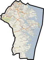
Area Map
Census Snapshot
> Population, 2006 estimate ... 509,300
> Population, 2000 ... 489,656
> Housing units, 2006 ... 201,603
> Homeownership rate, 2000 ... 75.5%
> Median household income, 2004 ... $66,087
> Mean travel time to work (minutes), 2000 ... 28.9
> Population, 2000 ... 489,656
> Housing units, 2006 ... 201,603
> Homeownership rate, 2000 ... 75.5%
> Median household income, 2004 ... $66,087
> Mean travel time to work (minutes), 2000 ... 28.9
Anne Arundel County Home Search
Area Guides
Baltimore City
Baltimore County
Anne Arundel County
Carroll County
Howard County
Harford County
Frederick County
Montgomery County
Prince Georges County
Services
Buy A Home
Rent A Home
Sell My Home
Seller Perfect Home
Estimate My Home Value
Perfect Home Finder
Apply for Financing
Invest in Real Estate
Social Media
![]()
![]()
![]()
![]()
![]()
![]()
Contact
Troy Williams
Associate Broker, REALTOR ®
Real Estate Professionals Inc.
5707 Calverton St. Suite 2D
Catonsville, MD 21228
mobile: 410.916.0704
office: 410.902.4452
broker: 410.234.2244